Staatsarchiv des Kantons Zürich
ArcGIS, QGIS or web apps can simply use this map with web map services. WMTS, TileJSON or XYZ tiles are provided for quick access to processed maps.
Sign in to get links.
Sign in to download GeoTIFF.
Overlay & compare
iiif viewer, iiif info json
Website
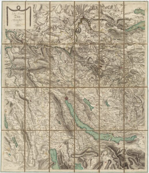
Karte des Kantons Zürich nebst einem Teil der angrenzenden Kantone
PLAN_A_60
Maps
Mit - wohl nachträglich angebrachter - farbiger Einzeichnung der Kantonsgrenze.
From 1801-01-01 to 1801-12-31
Orell Füssli und Cie., in Zürich
70.8 × 82.4 cm
1 : 120000
300