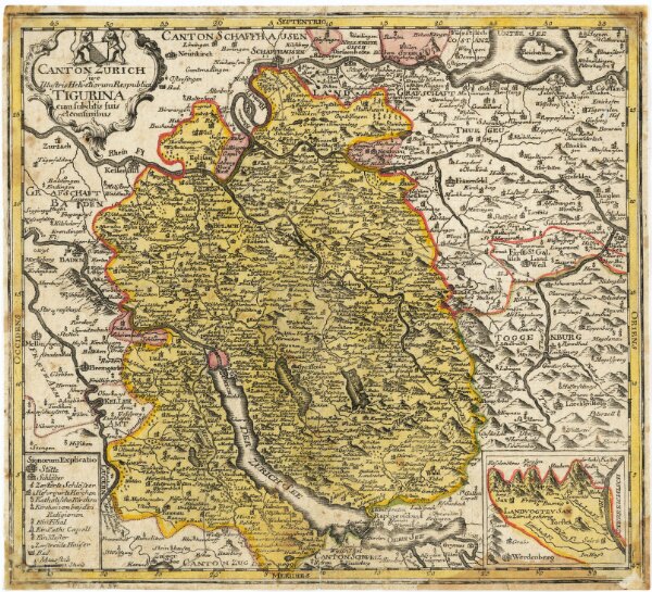
Karte des Kantons Zürich mit seinen Untertanengebieten und Grenzen von 1765
Identifier
PLAN_A_57
Collection
Maps
Description
Originaltitel: Canton Zürich sive Illustris Helvetiorum Respublica Tigurina cum subditis suis et confinibus. Verkleinerung der von Gabriel Walser verfertigten Originalkarte. Mit Erklärung der Zeichen und Nebenkarte der Herrschaft Sax-Forstegg.
Depicted date
From 1770-01-01 to 1770-12-31
Creator
Vermutlich: Walser, Gabriel (1695-1776), reformierter Pfarrer, von Teufen AR Herausgeber: Homännische Erben, in Nürnberg (Deutschland)